El Niño is a periodic phenomenon, recurring roughly every two to seven years, during which surface waters of the tropical eastern Pacific Ocean become unusually warm. Its appearance can produce major weather anomalies around the world, including floods, drought, famine, and the spread of disease.
The article explains the Spanish name El Niño as a reference to the Christ child, reflecting the historical association of the phenomenon with the Christmas season.
 |
| Image from the original article |
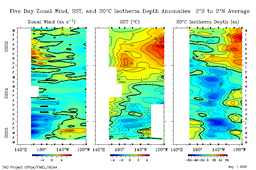
Pacific sea-surface temperature anomalies during the period discussed in the original 2015 article.
According to information then being reported by the U.S. National Oceanic and Atmospheric Administration (NOAA) and NASA, the 2015 El Niño was strengthening. Several observed variables resembled those of the powerful 1997 event. Measurements of Pacific sea-surface height and temperature, together with wind patterns, showed cooling in parts of the western Pacific while tropical waters farther east were warming substantially. [source]
NASA Jet Propulsion Laboratory climatologist Bill Patzert argued that whether the 2015 event ultimately proved slightly stronger or weaker than previous major events was becoming less statistically meaningful; in his analogy, the developing El Niño was like a growing child whose development could not simply be reversed. Sea-level anomalies during October suggested that the ocean's heat content was comparable to, or perhaps greater than, that observed in 1997.
The source therefore anticipated that the approaching Northern Hemisphere winter—especially in North America—would be far from ordinary, while also observing that the preceding decade's weather had made the very meaning of “normal” increasingly difficult to define.

Comparing 1997 and 2015
The accompanying maps compared Pacific sea-surface height during the first half of October in 1997 and 2015 using observations from the TOPEX/Poseidon and Jason-2 satellites. Both represented departures from average sea level. Redder areas indicated sea level several tens of millimetres above normal, associated in the article with thermal expansion of warmer seawater. Blue regions represented cooler water and lower-than-average sea level, while white indicated conditions closer to average. [source]
Patzert also pointed to weakening trade winds. Weaker easterly winds allow westerly winds and oceanic processes to move more warm surface water from the central and western Pacific toward South America. The source links this behaviour with the propagation of Kelvin waves across the Pacific during the first seven months of 2015. [source] [source]
NOAA's Climate Prediction Center was then reporting that model simulations placed the expected peak of the 2015 El Niño in late autumn or early winter. Researchers broadly expected a strong event, and the source cites an approximately 95 percent probability that El Niño conditions would continue through the Northern Hemisphere winter. [source] [source]
Expected effects in North America
 | |
|
Patzert and other NASA researchers expected the southern half of North America to have a cooler and wetter winter than usual, while northern areas were expected to be warmer and drier. The article nevertheless stresses that the instrumental record contains relatively few El Niño events and that other components of a changing climate make precise seasonal forecasts difficult.
What might it mean for Iran and the Middle East?
The relationship between El Niño and weather in the Middle East, including Iran, was described as considerably more difficult to establish. Research had produced differing results. The article cites a 1996 Weizmann Institute study reporting a relationship between El Niño and increased rainfall along the eastern Mediterranean during the preceding two decades, together with other work linking Middle Eastern precipitation to conditions over the western Indian Ocean and eastern Red Sea.
As a historical example, the source notes that during Iran's 1376–1377 agricultural year, coinciding with the 1997 El Niño, many Iranian cities experienced a comparatively wet year. Other records were interpreted as suggesting some correspondence between global drought frequency and El Niño events, although the article acknowledges that attributing recent Middle Eastern drought specifically to El Niño remained uncertain. [source]
The author therefore cautions against claiming that El Niño would necessarily reduce rainfall in any particular region of Iran. Even if precipitation increased, however, it might occur during warmer periods with greater evaporation or arrive in intense downpours that infiltrate the ground inefficiently. Thus additional rainfall would not automatically resolve long-term water-resource problems.
The article closes by considering possible economic consequences that were being discussed at the time, including disruption to food production and commodity prices. In Iran, the author speculated that drought-related agricultural losses combined with low oil prices could place additional pressure on the economy. [source]
All forecasts and economic expectations above are preserved in their original 2015 historical context.