The final solar eclipse of 2013 was an unusual form of the phenomenon. In what is known as a hybrid eclipse, the Sun initially entered an annular eclipse—this time at sunrise over the western Atlantic Ocean. During an annular eclipse, because the Moon is farther from Earth, it blocks only part of the Sun's light, leaving the Sun shining like a ring of fire around the Moon. As the geometry changed, the event transitioned into a total eclipse. [source]
For a little more than three hours, the Moon's shadow travelled along a path approximately 13,600 kilometres long and 58 kilometres wide across central Africa.
 |
Earth
Observatory
Robert Simmon
Jesse Allen VIIRS
|
The image is from NASA's Earth Observatory and was prepared by Robert Simmon and Jesse Allen using VIIRS data.
The image was acquired by the Visible Infrared Imaging Radiometer Suite (VIIRS) aboard the Suomi National Polar-orbiting Partnership satellite. The yellow line shows the path that experienced totality, while the accompanying map places that path in relation to central Africa. VIIRS captured the image at 13:25 GMT on November 3, 2013, approximately 38 minutes after maximum eclipse began. [source]
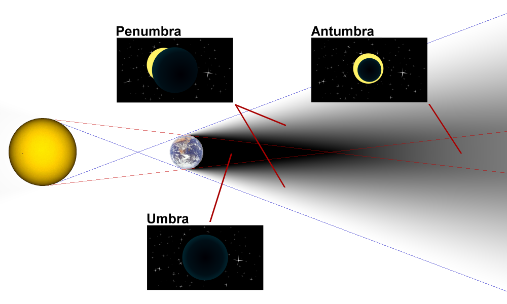
The dark region is produced by the combination of the Moon's umbra and antumbra on Earth's surface. Observers within the umbra experienced a total eclipse which, at maximum eclipse (12:47 local time as stated in the source), lasted 99 seconds. People within the antumbra experienced a partial eclipse.
The last eclipse of 2013 was particularly unusual because the eclipse transitioned through its different phases in an uncommon way, whereas hybrid eclipses normally begin as annular, become total, and then end as annular again. The source notes the date of the previous hybrid eclipse and, citing Sky & Telescope, gives a future date for the next such event.
The original article's link to the eclipse-path map is preserved below. [source]